
According to legend, the Great Wall was built by the first
emperor of the Qin Dynasty, Qin Shi Huang (Reigned 221-210 BC), though
historical records trace the true origin of the wall to defensive
fortifications built in the fifth century BC From the statement "Square
walls surround the Kingdom of Chu," we can trace walls with a total
length of 500 kilometers in what is now Henan Province dating back to
the Eastern Zhou Dynasty (770-256 BC). In addition to Chu, the kingdoms
of Qin, Qi, Wei, Zhao, Han and Yan all had their own separate defensive
walls spread about through the Yellow and Yangtze River basins, running
in different directions and beginning and ending abruptly. The walls of
this period bear little relationship to the wall of today with its
predominantly east-west configuration.
In 221 BC, the armies of
Qin conquered the abovementioned six kingdoms and unified China. Qin Shi
Huang ordered the demolition of the walls separating these kingdoms and
rebuilt a new "Great Wall," based on the walls protecting the northern
frontiers of Yan, Zhao and Qin. According to the Records of the Historian (shiji),
written approximately 100 BC, "General Meng Tian mobilized 300,000
laborers and built a great wall which followed the contour of the land,
taking advantage of natural defenses." This wall extended more than
6,000 kilometers from Lintiao (in Gansu Province) to Liaodong. Thus the
general plan of today's Great Wall was laid down during the Qin Dynasty
(221-206 BC).
During the Han Dynasty (206 BC- AD 220) Which
followed the Qin, in addition to making improvements in the Qin wall,
the Han emperors constructed a separate outer wall north of the Yinshan
Range with a total length of 10,000 kilometers. This was the longest
single wall built in ancient China. After the fall of the Han Dynasty,
the wall gradually decayed into ruins. In 1368, the founding year of the
Ming Dynasty, Emperor Taizu commanded his general Xu Da to direct the
reconstruction of the Great Wall. Beginning at the Juyong Pass, the work
went on for more than 100 years. Based on the general dimensions of the
Qin Wall, the Ming wall stretched from its westernmost point at the
Jiayu Pass more than 6,000 kilometers east to the Yalu River. The
section, which lies between the Jiayu and Shanhai, passes remains in
good condition today and is known throughout the world as the Great Wall
of China.


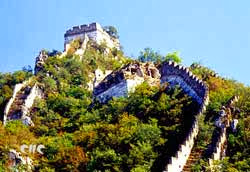
Setting out from Beijing, the most popular destination for
visiting the Great Wall is Badaling. Both trains and buses go to the
northwest of the city proper in a deep mountain-flanked gully 15
kilometers long. In summer, the peaks here are covered with brilliant
stretches of leaves and luxuriant flowers. As early as the 13th century,
the area was known for its beauty, and was listed as one of the"Eight
Great Sights of Yanjing." The name "Juyong" first appeared in the huainanzi,
a philosophical work from the second century BC, in the following
annotation: "The Juyong Pass is one of the nine great passes in the
country."
To the west of the Juyong Pass is a white marble
structure called the Cloud Platform (Yuntai), which was built in 1345 to
serve as the foundation for a set of three stone pagodas built at the
command of Emperor Huizong, the last ruler of the Yuan Dynasty. At this
time, the structure was known as the Pagoda Bridge (Guojieta). After the
pagodas were destroyed some time around the fall of the Yuan Dynasty
(1368), the Great Peace Temple (Tai' ansi) was built to replace them. But the temple was burned down in 1702 during the reign of Emperor kangxi.
The
Cloud Platform is pierced by a hexagonal arched gateway. Both the
ceiling and facades are covered with Buddhist carvings, including
depictions of the Four Heavenly Kings in relief executed with great
detail and expressiveness. Texts of Dharani sutras and an inscription
entitled "A Record of Charitable and Pious Pagoda Building" carved in
six languages -- Lantsha (Nepalese Sanskirt), Tibetan, Phagspa
Mongolian, Uygur, Western Xia and Han -- are valuable for the study of
philology. The inner roof of the arch is covered with mandala patterns
and Buddha images surrounded by flowers, all fine examples of Yuan
Dynasty craftsmanship.
The Juyong Pass area contains many relics
associated with popular legends. One of these relics, dating back to
the Northern Song Dynasty, is the Five Heroes Temple, which commemorates
the ostensible digging of the gully by five men of unusual strength.
The fanciful name of the Playing the Zither Gorge (Tanqinxia) is derived
from the clear and melodious sounds of the river flowing through it.

Continuing on from the Juyong Pass, one will arrive at Badaling,
the highest point along the entire length of the Great Wall. Between
Badaling and Juyong Pass, two Chinese characters Tianxian (Natural
Barrier) are carved into a steep and imposing cliff. During the Ming
Dynasty, two fortifications were built in this area, the Northern Gate
Pass on west and the Juyong Garrison on the east. By climbing up through
the pass and looking westward, one will be able to see a chain of
mountains stretching away to the horizon with a single defile leading
through them. To the north of the ridges near the wall is the platform
for Viewing the Capital (Wangjingtai) and on clear days the White Dagoba
in Beijing Park can be seen from here. By climbing over another slope
and following a flight of stone steps up to the highest point of the
southern section of the wall, one can see the dragon-like Great Wall
making its way over the mountains.
Strategic platforms were
built every 300 to 500 meters along the wall. These platforms served a
variety of purposes: for posting patrols and sentries; to serve as
observation posts; and as battle platforms for offensive actions and
weapon storage. Here there are also reinforcing walls built alongside
the wall proper and beacon towers for transmitting military information.
The Badaling section of the Great Wall most frequented by
visitors dates from the Ming Dynasty, Constructed of large blocks of
granite and bricks, the wall at this point is 6.6 meters high and 6.5
meters wide at its base, narrowing to 5.5 meters on the rampart. It is
wide enough to permit five or six horses to stand abreast.
In
recent years, the Chinese government has carried out restoration work on
the sections of the wall which have collapsed or been eroded by wind
and sand. Despite this, the great increase in tourists at the Great Wall
in recent years has led experts to suggest the opening of a "second
Badaling" to accommodate the great number of visitors. The "second
Badaling" is located to the northeast of Beijing proper and can be
reached by bus in approximately two hours. Built on the Great and lesser
Gold mountains (Jinshan), this section is also called the Gold Mountain
Great Wall. According to historical records, the construction of this
part of the wall was begun in 1571, and is part of the
1,000-kilometer-long section of the wall between the Shanhai Pass in the
east and Changping County in the west, which was the result of
cooperation between two famous Ming generals, Qi Jiguang and Tan Lun. In
terms of construction it is in no way inferior to the wall at Badaling.
The Great Wall at the Gold Mountain is seven meters high, six
meters wide, and built of rectangular slabs of stone. The brick-paved
walkway along the top of the wall is four meters wide and the
crenellated openings two meters wide. In the merlons (the solid
intervals between the crenels) there are small holes for observation and
shooting arrows. There are also special openings between the crenels to
insert flags for display or signal transmission.
The 158 battle
platforms in the Gold Mountain section of the Great Wall were designed
in a great variety of shapes-square, circular, oval and multi-cornered.
Their interiors are constructed of wood or brick and their roofs are
flat, domed or barrel-vaulted. There are also variations in the shape of
the archways, which give access to the battle platforms.
To the
north of Tiger Mountain is a huge solitary piece of rock, which has in
it an indentation one meter in diameter and 20 cm deep called the Spring
of Heaven. The water from this spring flows continuously in both the
rainy and fry seasons. Near the spring is a defense tower called the
Five Eyes Tower. Unique in design, the body of the tower is made of
rectangular stone blocks and the roof of polished bricks. Inside there
are two large barrel-vaulted ceilings, three corridors, 10 arched
openings and a central octagonal dome supported by four brick columns
arranged in a square. The stone columns are decorated with relief
carvings of flowers, which add a touch of elegance to this otherwise
austere building. Standing atop this tower, one can see the Great Wall
winding its way along the contours of the mountains. From this vantage
point, the wall appears like a ribbon of jade linking the Wuling
Mountain (the highest peak of the Yanshan Range) with the Sleeping Tiger
Range near Gubeikou.
Leaving the Five Eyes Tower and proceeding
along the wall, one comes to the Tower for Viewing the Capital
(Wangjinglou), which sits at a strategic point in Tiger Mouth Peak. The
tower commands a panoramic view of the surrounding countryside. Off to
the southwest, the mirror-like surface of Miyun Reservoir appears, the
outline of Beijing can be seen in the early morning and the city lights
become visible at night.

The Mutianyu section of the Great Wall was opened to tourists on
May 1, 1986. Located 73 kilometers from Beijing proper, it joins the
Juyong Pass in the west and Gubeikou in the east. A new 4,000-meter-long
pathway has been constructed from the road. It can also be reached by
cable car.
This well-preserved section was built about 1,400 years ago and reconstructed later during the Ming Dynasty. History of Ming Military Affairs explains why it was rebuilt.
When
Emperor Yongle returned north and reestablished Beijing as the capital,
he was exposed to attack on three sides. Harassment increased after the
reign of Emperor Zhengtong, so work was begun to strengthen and
lengthen the wall at Yalu River in the east.
The strategic
importance of Mutianyu was obvious, as many battles took place there. It
is said that during the Three Kingdoms period when Cao Cao exterminated
Yuan Shao's regime, his army advanced through Mutianyu. In the mid-Ming
years, the noted General Qi Jiguang was transferred from the south. As
Military Superintendent of Jizhen, he built observation towers and
provided storage areas for military weapons.
The highest
observation tower in the Mutianyu section is 540 meters above sea level.
Crenels and shooting holes are part of the solid construction. To the
east, the Great Wall continues across the mountain ridges, to the west,
it enters a point of strategic importance at a peak 1,044 meters above
sea level.
The Republic of India, located in the south of Asia
and comprising most of the Indian subcontinent, is the
second most populous country in the world and is the
world's largest democracy with over one billion people
and more than one hundred distinct languages.
The Indian economy is the fourth-largest in the world,
in terms of purchasing power parity.
The name India is derived from Sindhu, the local name
for the river Indus.
The country is called Bharat (pronounced as bhaarat;
after the wise and pious King Bharata of ancient times)
among Indians.
India borders Bangladesh, Myanmar, China, Bhutan, Nepal
and Pakistan on land, with Sri Lanka and the Maldives
just across the Indian mainland in the Indian Ocean.
Bharat Ganarajya
National motto: "Satyameva Jayate" (Sanskrit:
Truth Alone Triumphs)
Official language; Hindi (+17 other nat. lang.)
Capital; New Delhi
Largest City; Mumbai (Bombay)
President; APJ Abdul Kalam
Prime Minister; Atal Behari Vajpayee
Area; 3,287,590 km²
Population; 1,049,700,118
Independence; - Date From the British Empire
August 15, 1947
Currency; Indian Rupee (INR)
Time zone; UTC +5.30
National anthem; Jana-Gana-Mana
National song; Vande Mataram
National game; Hockey? Cricket
Internet TLD; .IN
Phone Calling Code; 91
History
The Indus Valley civilisation (also called the Sindhu-Sarasvati
Tradition) is one of the oldest cultural traditions
in the world, that goes back to at least 3000 BC.
The rock art tradition of India has been traced to 40000
BC in the art in Bhimbetaka in Central India and other
sites.
According to the Aryan invasion theory, Aryan tribes
from the northwest of India invaded about 1500 BC, and
their merger with the earlier inhabitants created the
classical Vedic culture.
Arab incursions starting in the 8th century and Turkic
in the 12th were followed by incursions by European
traders beginning in the late 15th century.
It is noteworthy that the above-mentioned Aryan Invasion
Theory is now being widely challenged with the use of
modern & scientific tools such as satellite imagery
from NASA.
Events mentioned in the Vedic texts have been astronomically
calculated to date back to the 5th millennium BC.
By subjugating the Mughal empire in the 19th century,
the British Empire had assumed political control of
virtually all Indian lands.
Mostly non-violent resistance to British colonialism
under Mohandas Karamchand Gandhi and Jawaharlal Nehru
led to independence in 1947.
The subcontinent was divided into the secular state
of India and the smaller Muslim state of Pakistan.
Pakistan occupied two non-contiguous areas, and a civil
war between West and East Pakistan in 1971, in which
India eventually intervened, resulted in the sedition
of East Pakistan to form the separate nation of Bangladesh.
Fundamental concerns in India include the ongoing dispute
with Pakistan over Kashmir, massive overpopulation,
environmental degradation, extensive poverty, and ethnic
and religious strife, all this despite impressive gains
in economic investment and output.
Politics
India is a Union of states with an increasingly federal
structure.
Officially it is declared as The Sovereign Socialist
Secular Democratic Republic of India.
India has as head of state a president, whose duties
are largely ceremonial.
The president and vice president are elected indirectly
for 5-year terms by a special electoral college.
Their terms are staggered, and the vice president does
not automatically become president following the death
or removal from office of the president.
Executive power is centred in the Council of Ministers
(cabinet), led by the prime minister.
The president appoints the prime minister, who is designated
by legislators of the political party or coalition commanding
a parliamentary majority.
The president then appoints subordinate ministers on
the advice of the prime minister.
India's bicameral parliament consists of the upper house
called 'The Council of States' (Rajya Sabha) and the
lower House called 'The House of the People' (Lok Sabha),
both of which were established by the Constitution of
India.
The Council of Ministers is responsible to the Lok Sabha.
The legislatures of the states and union territories
elect 233 members to the Rajya Sabha, and the president
appoints another 12.
The elected members of the Rajya Sabha serve 6-year
terms, with one-third up for election every 2 years.
The Lok Sabha consists of 545 members; 543 are directly
elected to 5-year terms.
The other two are appointed by the president.
States and territories
India is subdivided into 28 states, 6 union territories
and the national capital territory of Delhi:
Andaman and Nicobar Islands, Andhra Pradesh, Arunachal
Pradesh, Assam, Bihar, Chandigarh, Chattisgarh, Dadra
and Nagar Haveli, Daman and Diu, Delhi, Goa, Gujarat,
Haryana, Himachal Pradesh, Jammu and Kashmir, Jharkhand,
Karnataka, Kerala, Lakshadweep, Madhya Pradesh, Maharashtra,
Manipur, Meghalaya, Mizoram, Nagaland, Orissa, Pondicherry,
Punjab, Rajasthan, Sikkim, Tamil Nadu, Tripura, Uttaranchal,
Uttar Pradesh, West Bengal.
Geography
Located on the Indian subcontinent, India consists roughly
of three major parts; in the north the massive Himalayas
mountain range (with the highest point being the Kanchenjunga
at 8,598 m) and the Indo-Gangetic plain (with deserts
in the western end), and in the south the extensive
Deccan plateau.
The latter is part of a large peninsula in between the
Bay of Bengal to the east and the Arabian Sea to the
west, with both being part of the greater Indian Ocean.
India is home to several major rivers such as the Ganges,
the Brahmaputra, the Yamuna, the Godavari and the Krishna.
A small part of the upper course of the name-giving
Indus lies within Indian territory.
The Indian climate varies from tropical monsoons in
the south to more temperate climate in the north.
Economy
India's economy encompasses traditional village farming,
modern agriculture, handicrafts, a wide range of modern
industries, and a multitude of support services, including
software.
In fact, India's software exports alone are around $10
billion(2003).
However, a quarter of the population is still too poor
to be able to afford an adequate diet.
India's international payments position remained strong
in 2001 with adequate foreign exchange reserves, and
moderately depreciating nominal exchange rates.
As measured by GDP in US Dollars, India's 2002 output
of $481 billion ranked it 12th in the world.
As measured by GDP on Purchasing Power Parity basis,
India's 2002 figure of $2.66 trillion makes it the fourth
largest in the world.
Growth in manufacturing output has slowed, and electricity
shortages continue in many regions.
India has large numbers of well-educated people skilled
in the English language; India is a major exporter of
software services and software workers.
Demographics
India is the second-most populous country in the world,
with only China having a larger population.
Language, religion, and caste are major determinants
of social and political organisation within the highly
diverse Indian population today.
Hindi, in the Devanagari script, is the only official
federal language and individual states and territories
have adopted 17 other co-official languages.
These are the Dravidian languages of Kannada, Malayalam,
Tamil, and Telugu, and the Indo-Aryan languages of Bengali,
Marathi, Urdu, Gujarati, Oriya, Punjabi, Assamese, Kashmiri,
Sindhi, Nepali, Konkani and the classical language of
Sanskrit.
Many other languages belonging to both groups are spoken
as well.
English, though only an associate or 'link' language,
is still widely in use in law and government, particularly
in the higher echelons.
Although 83% of the people are Hindus, India is home
to the world's second largest Muslim population.
Other smaller religious minorities include Christians,
Sikhs, Jains, Buddhists, jews and Parsis.
The caste system once reflected Indian occupational
and religiously defined hierarchies.
Traditionally, there were four broad categories of castes
(varnas), though they consisted of thousands of castes
and subcastes, whose relative status varied from region
to region.
The caste system was an important social factor for
most Indians till the early 1900's.
The embracement of the lower castes into the mainstream
community was brought about by Mahatma Gandhi who called
them "Harijans" (people of God).
Presently, India has tough laws against discrimination
on the basis of caste.
There is a policy for the socio-economic upliftment
of the erstwhile lower castes, by the provision of free
education till graduation, reservation of admission
seats in institutions for higher education, a 50% quota
in government jobs and faster promotions.
However, caste remains a significant factor in the political
life of the country as well as in some social customs
such as marriage.
Culture
Indian culture is an expression of the numerous and
successive waves of influences in the subcontinent with
the Northern part of India being subjected to this more
than the South.
What follows constitutes just a small sample of a vast
tradition.
In music, two important forms are the Carnatic and the
Hindustani, the former from South India, a much purer
form and the latter from North India deriving a lot
from Muslim influences.
In literature, oral and written forms prevail.
Apart from the Vedas which are a sacred form of knowledge,
there are other works such as the epics of Ramayana
and Mahabharatha, treatises such as Vaastu Shastra in
Architecture and Town planning and Artha Shastra in
political science.
Urdu poetry is an example of a linguistic synthesis.
The literature of the Sangam period in Tamil is renowned.
Many dance forms exist in India - Bharata Natyam, Odissi,
Kuchipudi, Kathak, Kathakali, etc., mostly they have
a narrative form, telling stories.
Other forms such as street theatre and puppetry are
also found.
Festivals can also be included as part of Indian culture
because they are a way of life in India.
There are many of them -Diwali, Vijayadasami, Pongal,
etc., they are not only religion-based but also include
those glorifying important stages in a person's life,
seasonal cycles, etc.
Indian science was advanced in ancient times - Aryabhatta
and Bhaskara were important scientists who studied planetary
motion.
The Arabic numerals are actually an Indian contribution.
Traditional dresses in India include the Sari (Saree),
Salwar Kameez, Dhoti and Kurta.
In cuisine, rice and wheat form the staple diet.
Some popular dishes include Thali- a full fledged meal,
Dosa, Idli and Chapati.
Movies are an integral part of everyday life in India,
most notably the Hindi, Tamil and Telugu for their commercial
bases, and Bengali and Malayalam for its artistic leanings.
Though each region has a specific culture, in recent
times there is a growing tendency to merge boundaries
and imbibe aspects from other regions.
Also, with increasing globalization, and due to the
liberalisation of the Indian economy in the early 90's,
there has been influence of Western culture.
So there is Indi-pop in music , Hinglish or Tanglish-
English flavoured with terms from local language used
most prominently in fields such as advertising, pizzas
with indigenous spices, experimental dance and theatre
forms, and so on.
The invasion of cable TV has spawned an entirely new
popular culture.
Apart from these historical and context specific forms,
what an Indian sees as important in Indian culture are
abstract qualities such as hospitality, family values,
acceptance and toleration of differences, resilience
and co-existence.
Sports
As far as sports are concerned, though not India's national
sport, cricket is a very popular game today and India's
size has made it the game's financial powerhouse.
Some other popular sports - hockey, tennis, chess. (Chess
is supposed to have originated in India).
Some traditional indigenous games -kabaddi, gilli-danda.


